Walking Saskatoon braved arctic conditions to take a look at some of the major pedestrian projects that were completed in 2025 that we haven’t covered already.
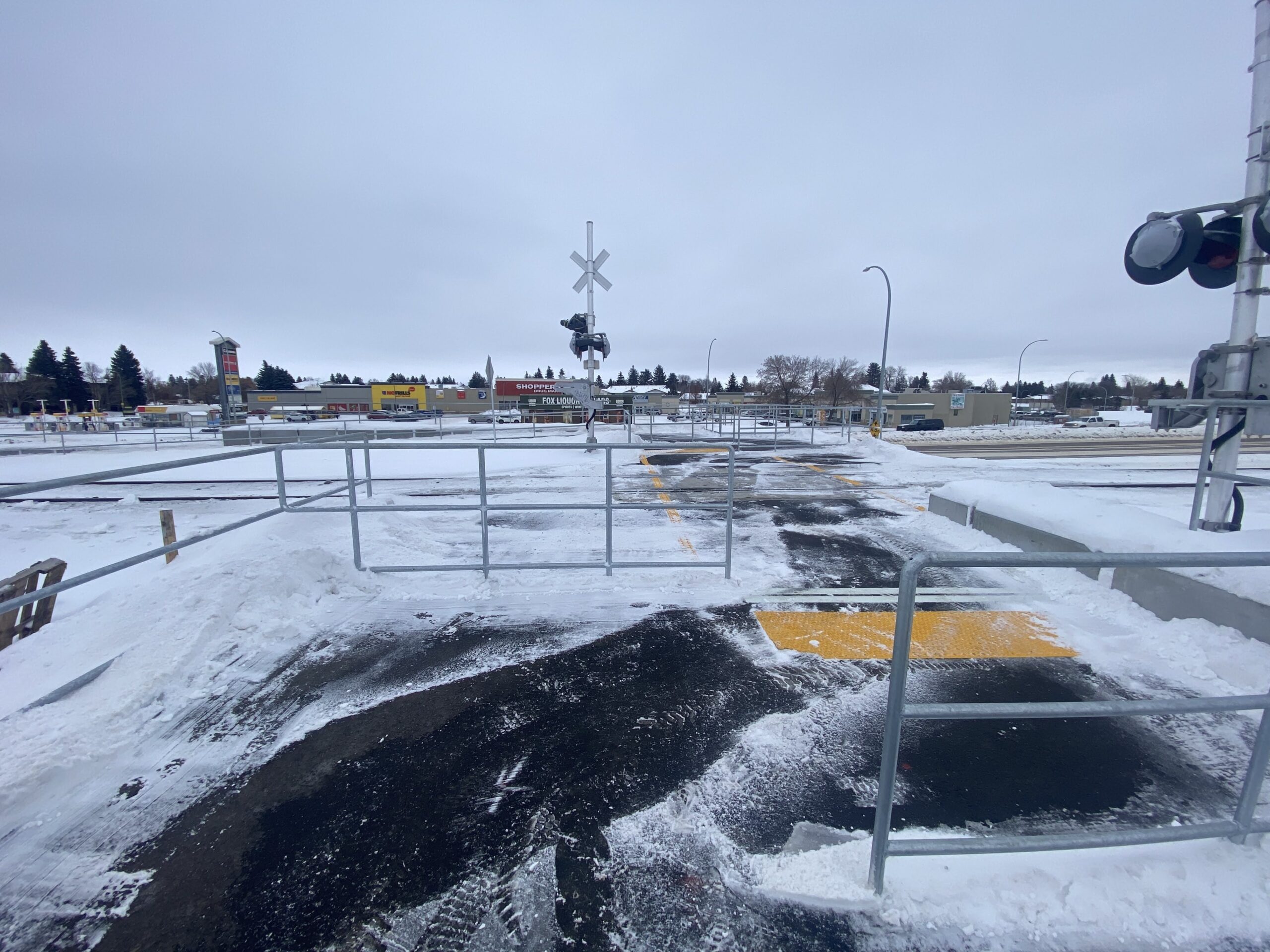
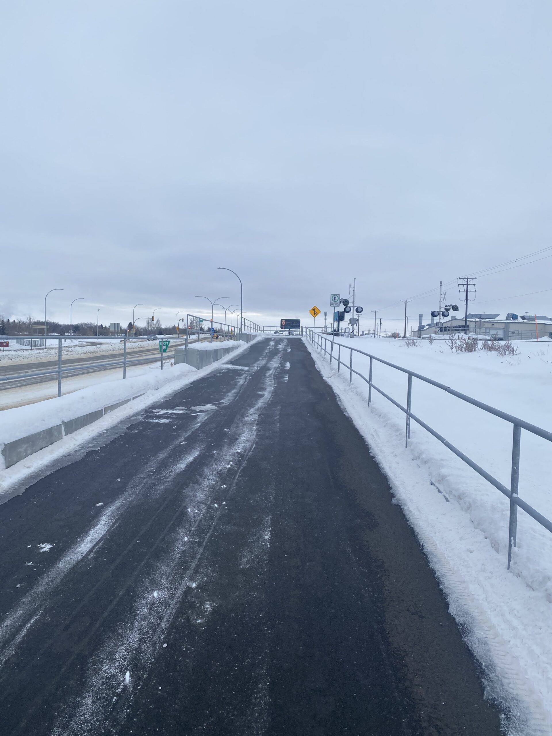
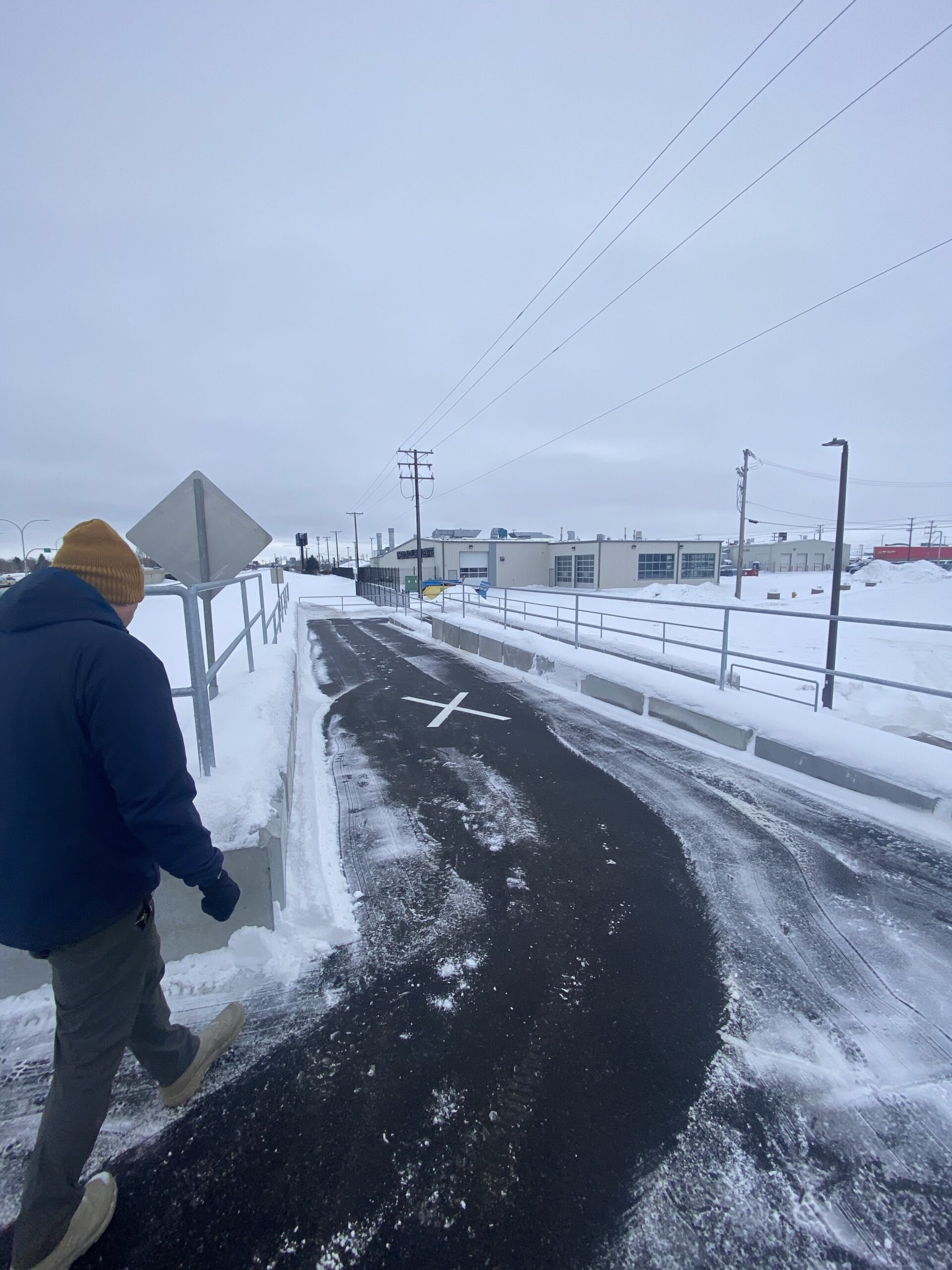
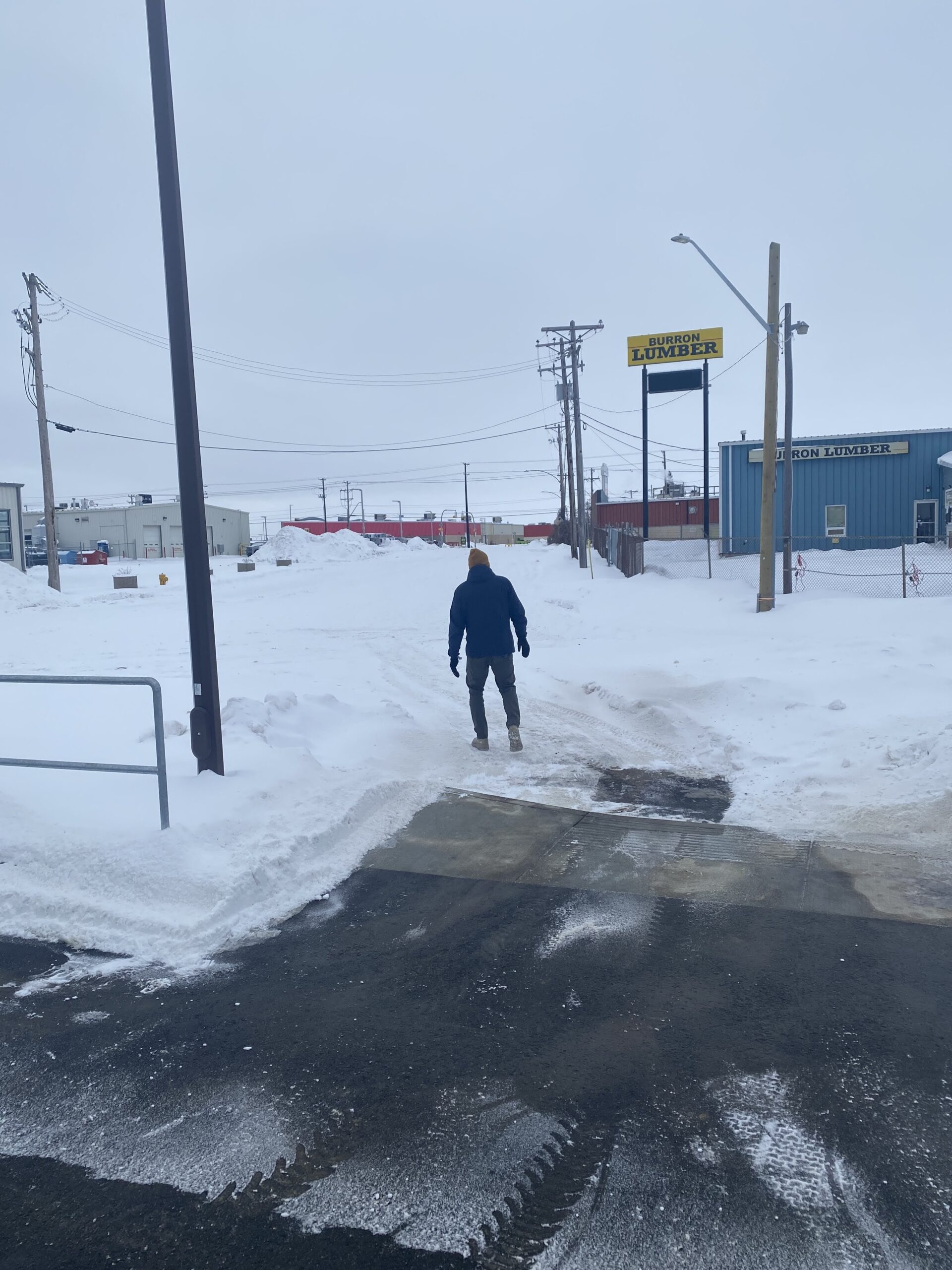
One of the most high-profile projects completed this year was the pedestian crossing over the train tracks at Warman and Assiniboine connecting to 43rd Street East. This is a hugely important crossing as its the only safe and legal way for people in the north end to get back and forth to North Industrial over the train tracks between 33rd and 51st, a huge stretch. Credit to Councillor Donauer for getting this project funded.
Pedestrian-activated rail crossing at Assiniboine and WarmanAccesible ramp at Warman/Assiniboine leading to crossing.Taking the ramp down to 43rd.Arriving at 43rd Street
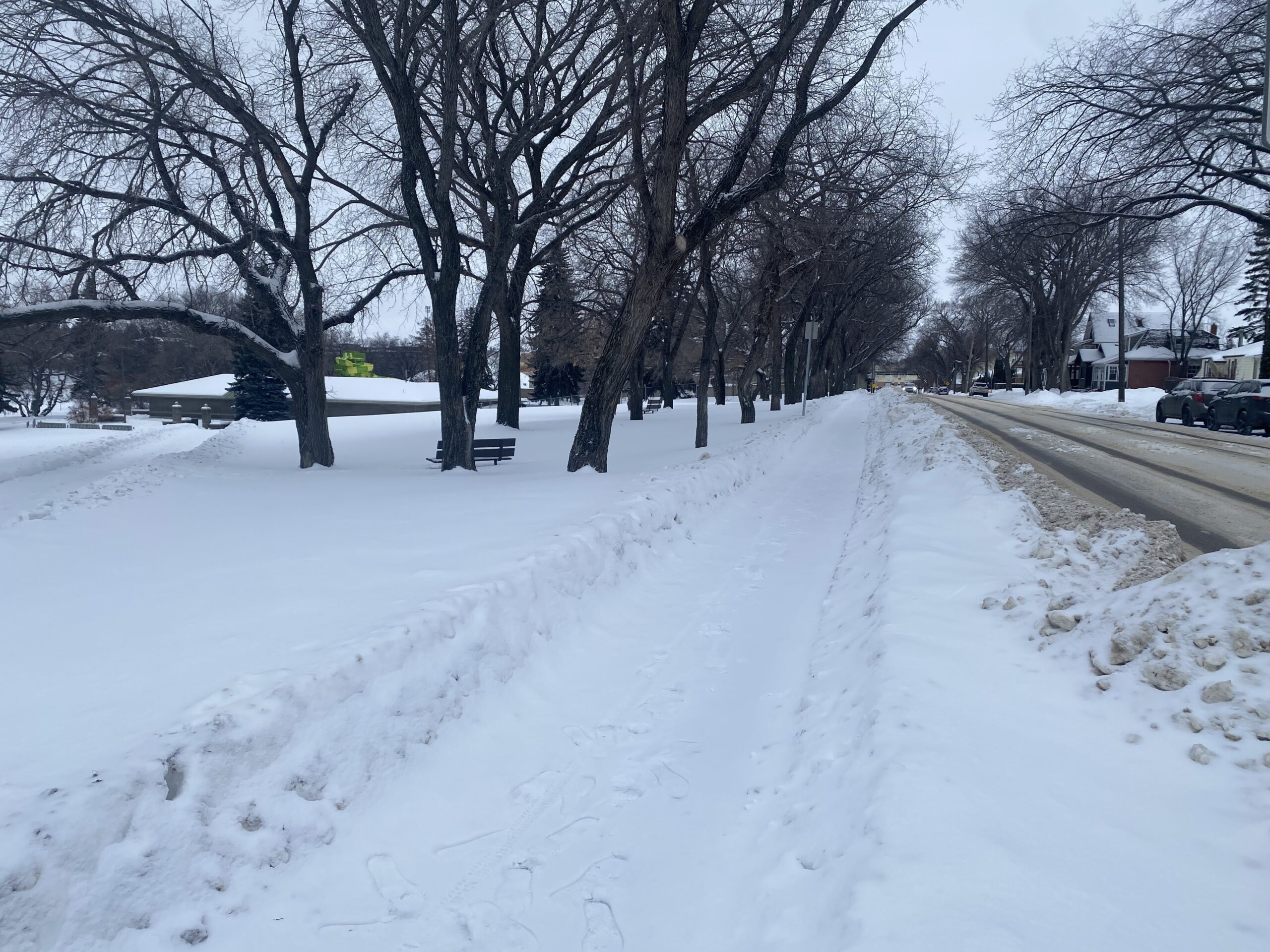
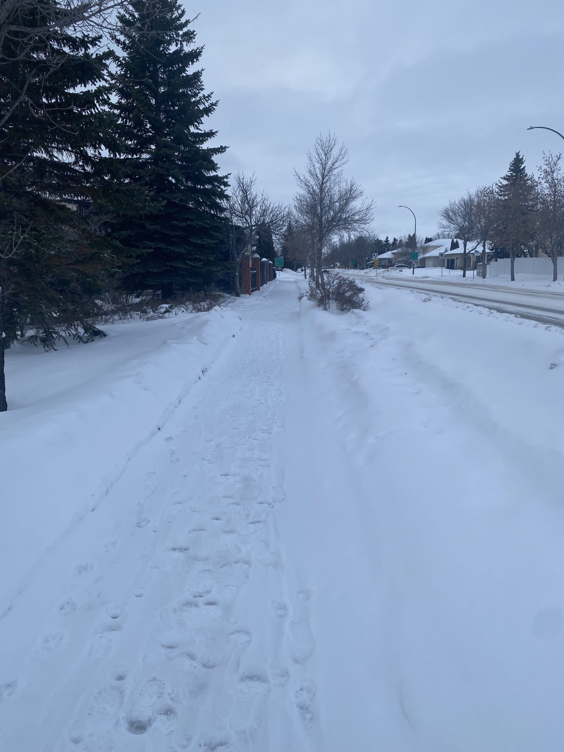
The city slowly (slowly) is actually connecting up North Park to the Meewasin, whereas now almost every last block to the river doesn’t have a sidewalk. Here’s an important start to fixing that, a sidewalk connecting up Prince of Wales Avenue and Pest Hill to the Meewasin.
New sidewalk on Prince of Wales Avenue to Spadina
Another common type of missing sidewalk in the city are blocks along parks. This was a particularly important project to fill one of those gaps, on the east side of Avenue H South, allowing much safer access to Riversdale Park and the river for residents of King George.
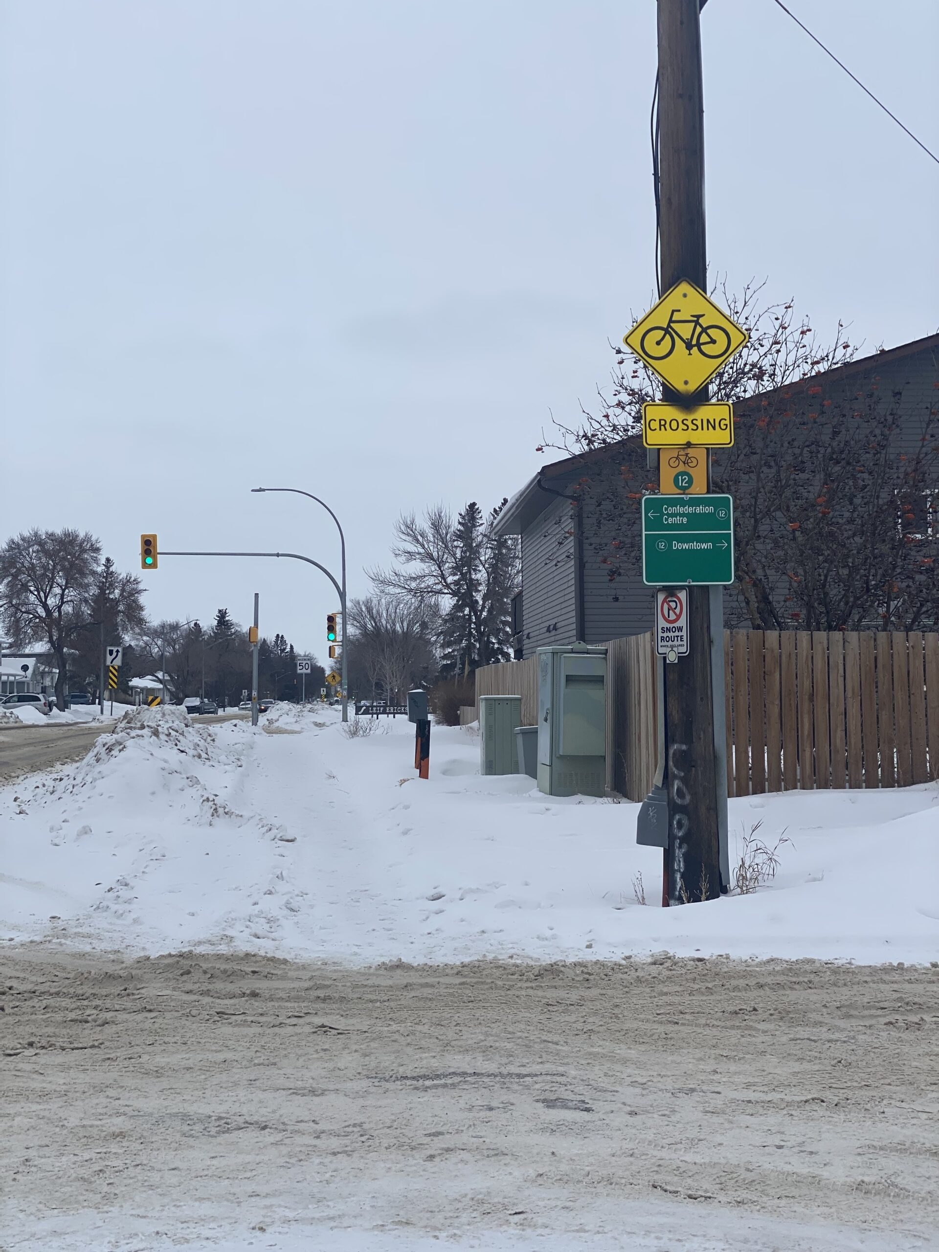
The City continues its good work on the 22nd/23rd Street corridor, here filling in the gap down Avenue W from 22nd to 23rd, complete with signalized crossing on the 23rd Street Bikeway
Over to the east side, another park-adjacent (and school-adjacent) sidewalk on Egbert Avenue next to Sutherland Elementary. Great project.
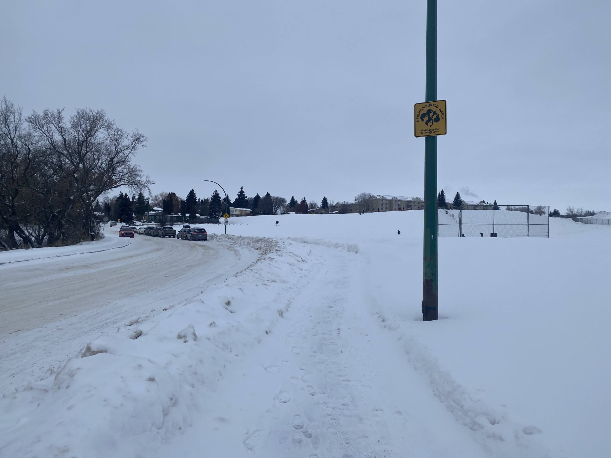
And, last but not least, new sidewalk(s) on the west side of Kenderdine in Arbor Creek, from Kerr to Forsyth, bordering John Avant Park. We saw many people walking their dogs during our brief time there (now finish up Kerr to McOrmand!) Also a new sidewalk inside the University Heights suburban centre along Attridge.
Stay tuned for more updates in 2026, which should also include a lot of work on the WCMUC rail trail!
22nd Street has always been Ground Zero for pedestrian safety in Saskatoon. A long, high-speed 6-lane stroad with big gaps between safe crossings, poorly maintained sidewalks and intersections, as well as a major rail line crossing, all right through the middle of neighbourhoods with a high level of pedestrians who need access to schools, hospitals and shopping all along the corridor. We’ve covered this corridor a lot, from a survey of winter walking conditions in2018 to solutions we proposed to help fix 22nd Street.
Luckily, the last several years, often helped by the efforts of ex-Ward 2 councillor Hilary Gough, the corridor has seen a large number of pedestrian safety improvements, many of which we’ve covered here, from fixes on 22nd itself:
🚦 New and improved crossing alert! A pedestrian-actuated signal has been installed on 22nd Street and Avenue V. This means safer, more efficient crossings for everyone. Let's walk safely, together! 🚶♂️🚶♀️ #SaferCrossing#CommunitySafety#yxepic.twitter.com/Oddt5HAJZv
This may not seem huge but it's one of the most important projects in Saskatoon it's at one of the highest fatality areas in the city: a new pedestrian-activated crosswalk at 22nd/Avenue X right next to the last grocery store in the core west side. @SenosTimon@troydavies4pic.twitter.com/Yuf95Gl5qG
to many projects, especially sidewalk infill, on the adjacent streets of 23rd and 21st. Those parallel streets, as we discussed in our original coverage, were safer for walkers in terms of traffic volume and intersection navigability but had no sidewalk coverage for large numbers of blocks, a huge problem for pedestrians who were stuck between the devil and the deep blue sea when it came to deciding where to walk.
And, probably the biggest project along 22nd, the West-Central Multi-Use Corridor, a project to make a safe active transporation path along the CPKC rail line that crosses 22nd diagonally around Avenue F.
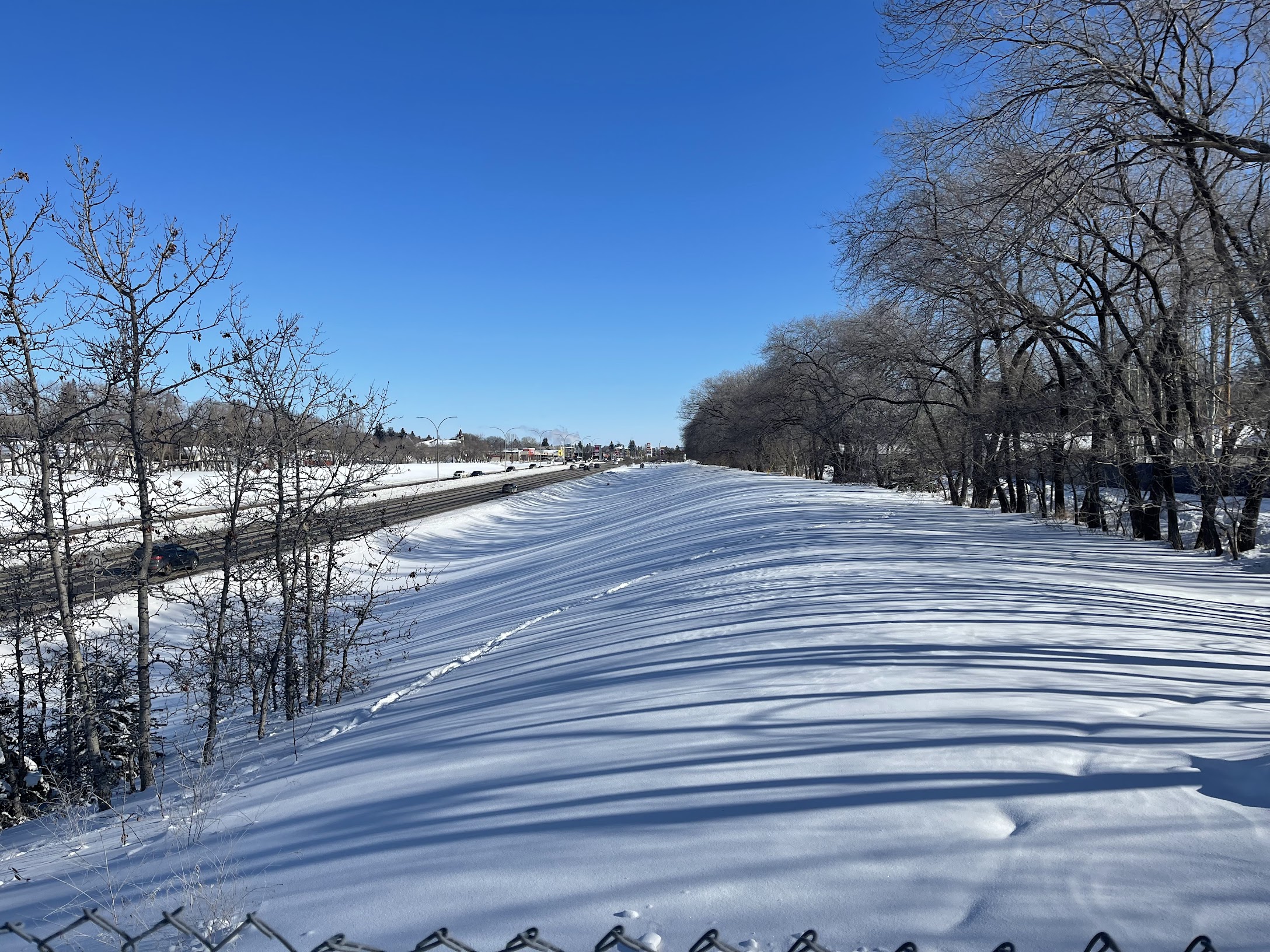
A big move in 2025 has been a focus on 22nd as it moves past Circle Drive and into Confederation Park/Fairhaven and neighbourhoods west. The west-side suburban neighbourhoods have always suffered from poor intra-neighbourhood walking access, with both 22nd and Circle acting as hard barriers to connectivity. Circle Drive, in particular, restricts access to the Downtown core, with pedestrians and bikers funnelled to a singular path on the west side of 22nd or a handful of poorly maintained tunnels under Circle.
The next several years will see positive change to those problematic sections of 22nd west of Avenue X and into Confederation Park, Fairhaven, and Kensington.
First, the construction of a south-side sidewalk from 22nd and Witney Avenue to connect up to the pedestrian overpass on Circle to make it easier for walkers from the south side to avoid having to cross 22nd at Avenue W against heavy traffic.
Looking towards Witney Avenue down 22nd from Circle pedestrian overpass
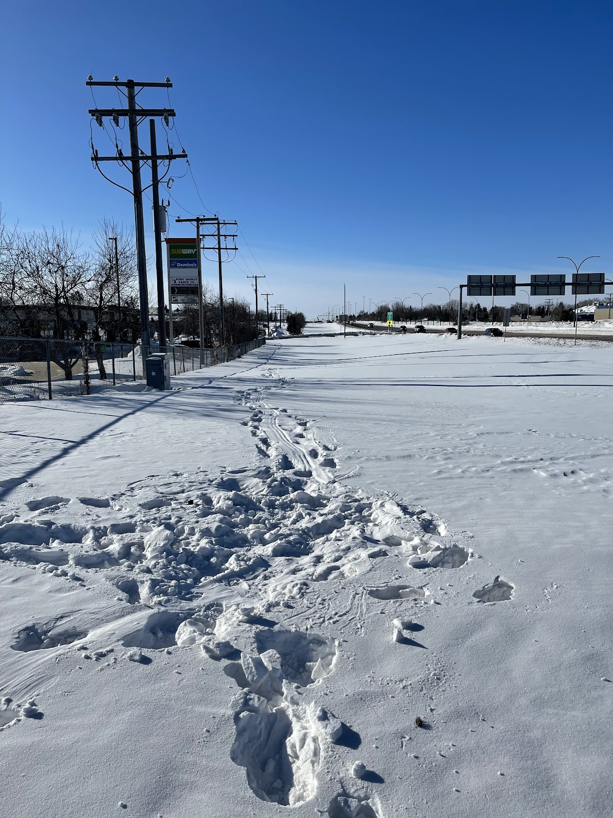
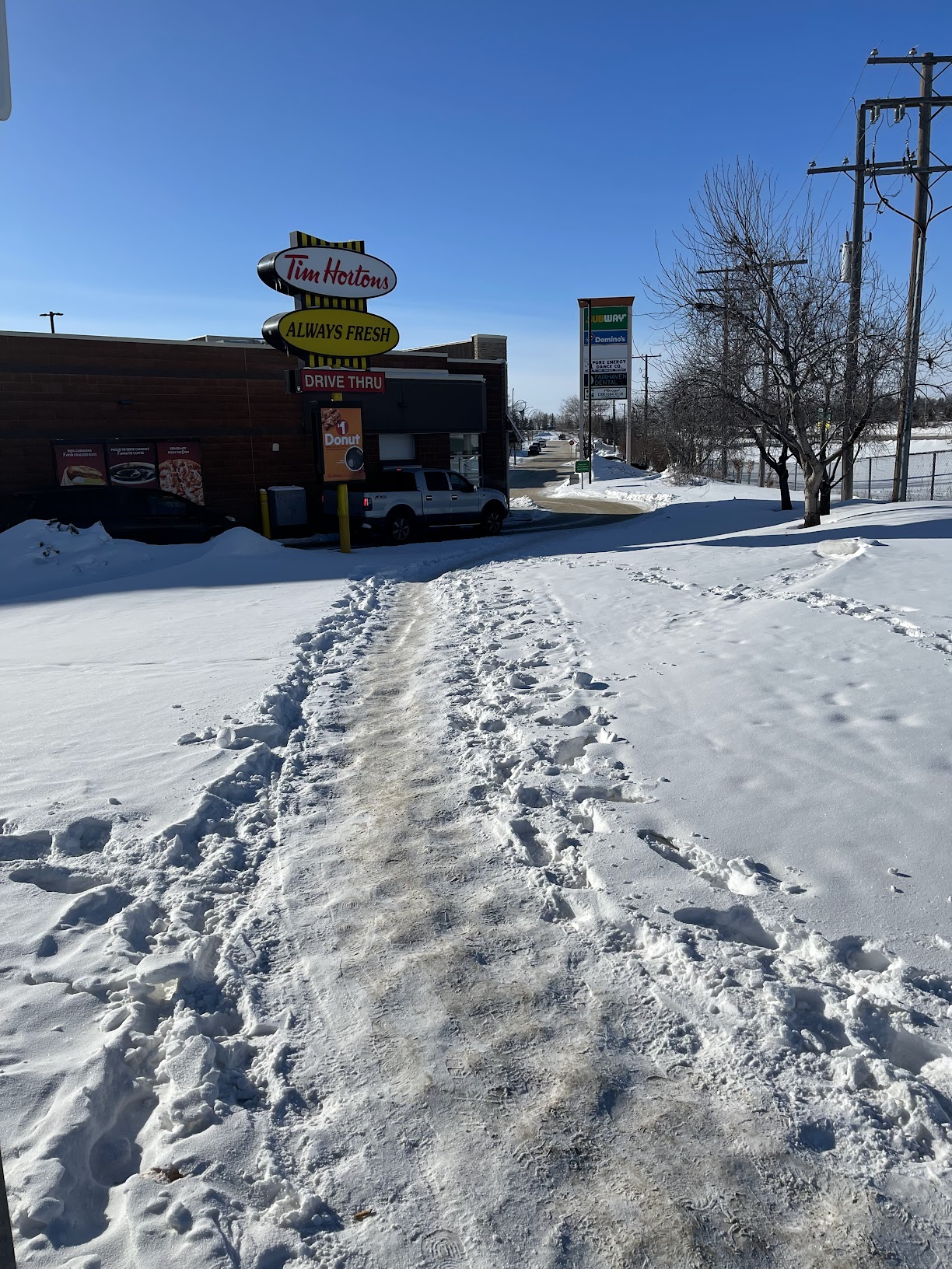
Second is the improvement of the southwest pedestrian infrastructure at the corner of Diefenbaker and 22nd and the addition of a pathway from Diefenbaker to Confederation Drive (unfortunately concurrent with the addition of a third car lane). This is a hugely important and highly trafficked intersection for pedestrians, really providing one of the few safe crossings of 22nd west of Circle and it’s a disgrace that it’s nearly half-a-century of waiting for a sidewalk on this section of street. This area is filled with desire paths as pedestrians are force to cut through fast food drive through lanes and muddy and snowy medians to try and get to their destination.
Desire paths on the west side of 22nd from Diefenbaker to ConfederationIn the absence of any sidewalk on 22nd, icy shortcutting through the Tim Horton’s drivethrough is popular.
City Admin recommended several projects for federal funding, a proposal that will be heard in committee this week (January 2025). We’re going to cover all the proposed projects, starting with the Idylwyld multi-use path near SaskPoly.
Despite the pending relocation of SaskPoly, this is still an excellent project that continues the long work of making Idylwyld less of an awful experience to walk along or cross. This will connect up the SaskPoly campus and 31st to the 33rd Street multi-use pathway, making it a much better experience for walkers and cyclist on the east side of Idylwyld. In addition, this will give a lot more space for the BRT station in front of the main SaskPoly building.
The city posted their full AT capital plan at a recent meeting. A useful document to see what changes are coming to the city’s pedestrian and bike network.
The city released its sidewalk infill construction list at the end of 2023, it’s great to see what got done and what is planned for the next few years. It’s important to keep this program funded after 2025.
As part of the construction of the WCMUC (West-Central Multi-Use Trail) the city has come up with a design to fix the rail/road crossing at the confluence of the CP tracks, Avenue N and 19th Street. This unsafe crossing situation has led to complaints from both CP and area residents. This is the situation now:
Our favourite time of year, new sidewalk infill season! The following streets are getting sidewalks over the next three years, thanks to city council for making this happen!
McPherson Avenue from Ruth St to Elm St (both sides)
McPherson Avenue from Taylor St to 7th St (both sides)
Kenderdine Road from Park entrance to Kerr Rd
Isabella Street from Clarence Ave to Lansdown Ave (North side)
Diefenbaker Drive from 22nd St to Fairlight Dr (West side)
Duke Street from the Lane West of 10th Ave to King Cres (South side)
21st Street West from Avenue I South to Avenue P South (North side)
21st Street West from Avenue U South to Witney Avenue (South side)
29th Street West from Pierre Radisson Park to Avenue L North (South side)
18th Street West from Avenue U South to Avenue S South (both sides)
Ewart Avenue from 8th Street to Main Street (East side)
Grant Street from North of Spark Avenue (both sides)
8th Street East from Boychuk Drive to Golf Course (South side)
Boychuk Drive from 8th Street to Briarwood Road (West side)
Prince of Wales Avenue from Lane East of Empire Avenue to Spadina Crescent (both sides)
Avenue H South from 13th Street to 15th Street (East side)
St. Henry Avenue from Hilliard Street to Isabella Street (East side)
Victoria Avenue from Ruth Street to Elm Street (both sides)
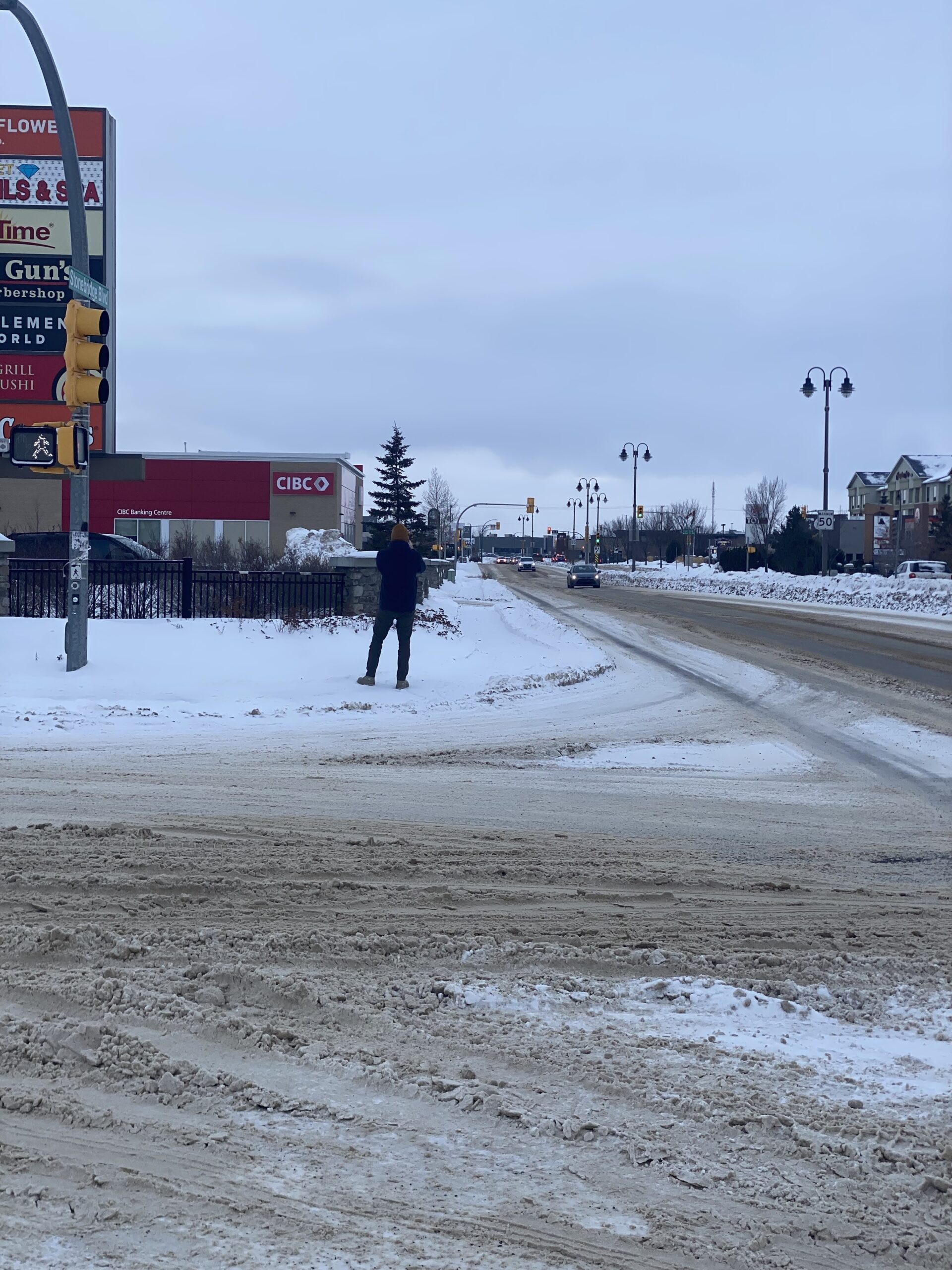
Stonebridge Boulevard from Clarence Avenue to Wellman Crescent East intersection (South side)
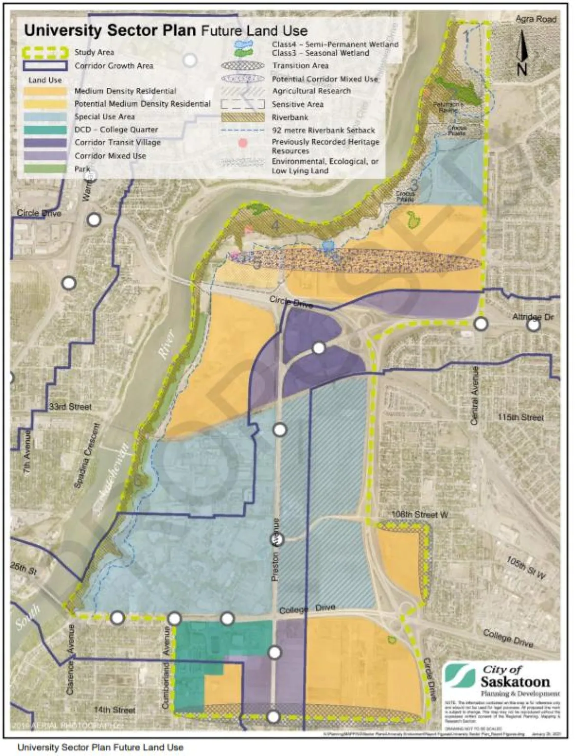
In Summary: The City of Saskatoon needs to prioritise developing the environmentally and fiscally sustainable University Sector neighbourhoods over disconnected greenfield developments. Additionally, the city should completely cancel the development of the University Heights #3 neighbourhood.
Walking Saskatoon spends a lot of time advocating for the retrofitting of pedestrian infrastructure into existing neighbourhoods. What if we didn’t have to?
The true walkability of a city is determined well before any concrete is poured or houses built. Where neighbourhoods are located and how they are designed are by far the biggest influences on transportation choices made by residents. The walkability and sustainability of a city follow inexorably from the area and neighbourhood master plans developed by city planners and housing developers years before construction.
The City of Saskatoon is currently at an important crossroads when it comes to choosing which new neighbourhoods to develop next. Saskatoon is in a unique position for a North American city, in that there are significant amounts of undeveloped land near the centre of the city’s geographic footprint. Critically, these lands are not brownfield or greyfield industrial plots in need of expensive remediation. In addition, the University of Saskatchewan has decided to relocate its research fields and endowment lands outside of the City. The lack of any serious manufacturing history in the city, combined with the University’s massive land holdings have given the City the chance to develop new, truly walkable neighbourhoods close to existing services.
City of Saskatoon University Sector Plan
To increase walkability in Saskatoon, developing the University Sector Plan (USP) neighbourhoods need to be the absolute first priority for the city. They are substantially served by existing road, pathway, sewer and water infrastructure, making them a lot cheaper for the city to develop than greenfield neighbourhoods. Not only is it cheaper for taxpayers, but the sector’s proximity to the University, the Meewasin Valley, North End Industrial and Downtown makes these neighbourhoods ideal for walking and biking. More active transportation means further savings for the City on transportation maintenance cost, while improving the quality of life and health of neighbourhood residents. The University explicitly mentions active transportation as a primary design goal of the University sector neighbourhoods, ensuring that their central location won’t be wasted with car-centric design.
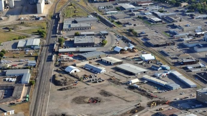
Another infill neighbourhood the city should prioritise for development is the North Downtown/Idylwyld corridor. The area’s location, bridging North Downtown with the Saskatchewan Polytech campus, makes it a prime candidate for student residences and other Sask Poly expansion. The North Downtown area master plan was developed by the city ten years ago, but it clearly has no momentum. This is an opportunity to replace the current plan with a more student-focused one. Replacing the thousands of daily car trips made by commuting students with a walkable route to campus would be a major benefit for both the students and the city.
North Downtown Industrial
While new infill neighbourhoods and infill in existing neighbourhoods should clearly be preferred for priority development, it still may not be enough to house a population of 1 million by 2050, if those projections come to pass. This means we will have to build greenfield neighbourhoods, but we must choose ones that integrate well with the city’s active transportation plan and are environmentally sustainable.
One planned neighbourhood that clearly fails that test is the upcoming University Heights #3 neighbourhood. This neighbourhood is part of the University Heights sector development, which is in the process of building out several neighbourhoods in an environmentally sensitive prairie wetland area. In addition,the Province is planning to build out a major highway through the area, further compounding environmental and financial damage. The last area to be developed(UH#3), is the worst environmental offender of all, planned right on top of the Northeast and Small Swales, two locally and regionally important environmental areas. This is the kind of damaging greenfield development that can be easily cancelled in place of further emphasising the fantastic infill opportunity Saskatoon possesses.
North East Swale in the University Heights Development Sector