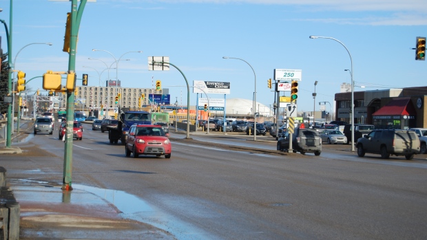
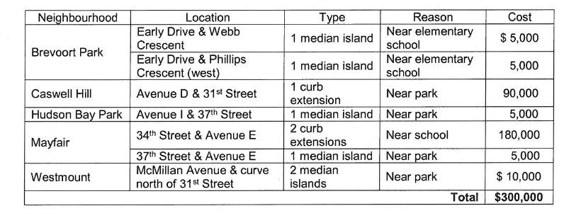
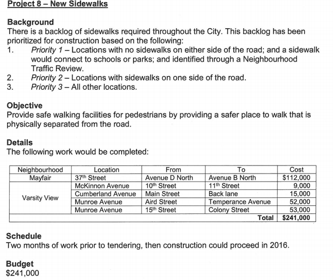
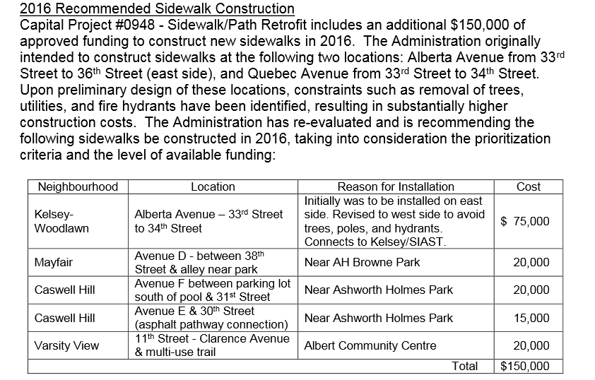
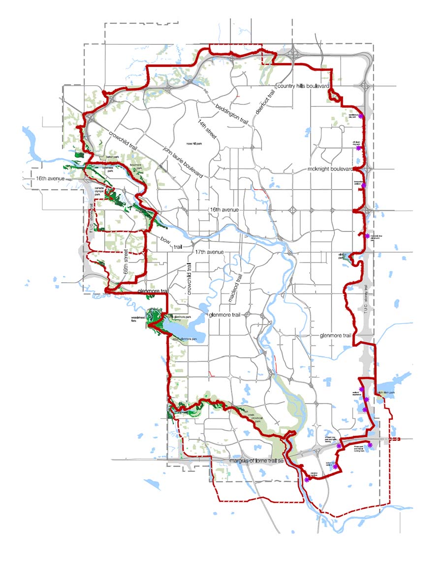
The following streets will get sidewalks this year where none existed before (as long as council agrees to spend already budgeted money):
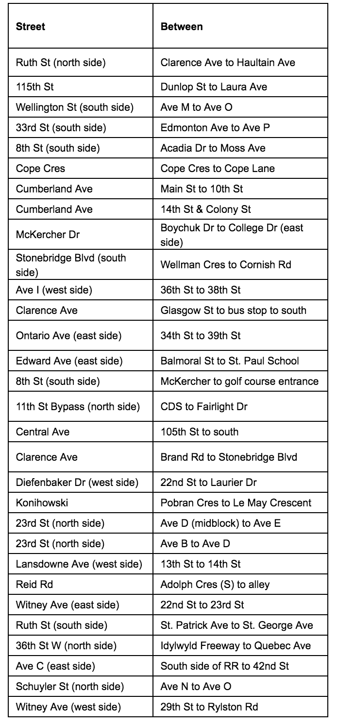
Some very high-profile problem blocks will get much needed sidewalks:
Cumberland from 14th to Colony, a major thoroughfare for University commuters and home to a mud-and-snow-bound bus stop:
How about Clarence from Brand to Stonebridge Blvd? A new suburb designed to fix the mistakes of past neighbourhood efforts with regards to walkability but where they forgot to put sidewalks on many major roads?
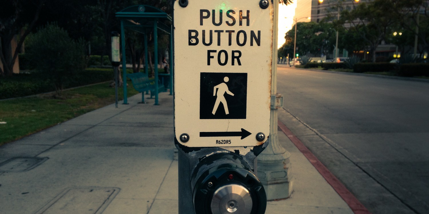
#sidewhere location 8th and Moss!
As we discussed during last year’s release of the list the budget line item for sidewalk infill has no ongoing funding attached, but rather relies on year-to-year one-time allocations. Last year, red-light camera fine money was used. This year saw ten times the money spent ($2.3M vs $240k) as federal money from the Public Transit Infrastructure Fund was used this year.
This led to some changes for the criteria used to select streets to construct sidewalks on. Last year, there was a formula used that incorporated access to parks and schools. This year, access to bus stops was used as the primary criterion given the transit-focused funding source.
Next year, the fight for funding begins again. Walking Saskatoon will be heavily lobbying on the issue, as well as pushing for more transparency in the judging criteria and list of streets that are under consideration for sidewalk infill. However, this year is the most successful ever for infill sidewalk construction in city history and both council and administration are to be commended for their attention to this issue.